Weather

2019 was a year of meteorological madness that many folks with agricultural interests would like to forget. From the “pineapple express” to the “polar vortex” to a “bomb cyclone,” there was something for everyone, often with impactful consequences.
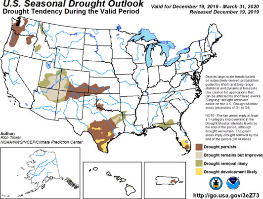
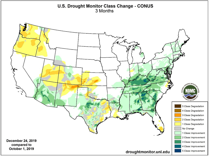
Heading into 2020, conditions in the Pacific Ocean are neutral from an El Niño perspective, but there are other pools of above-normal water temperatures that may impact weather conditions in the U.S. throughout the winter. Signals of this are evident as the 2019-2020 winter has gotten off to a cold and snowy start throughout the Northern Plains. Looking ahead through the remainder of the winter, the trend should continue and expand to the East Coast through the Great Lakes states. Given the lack of a strong El Niño signal, normal amounts of precipitation are likely across the Pacific coast. However, a fast-moving and active storm track will be present, which will bring bouts of needed rain and snow across the West. Drier than normal conditions that developed during the fall in the Southern Plains are likely to persist and expand through the winter, while seasonally normal conditions are expected in the East. Expect substantial variability in the Eastern states due to the active storm track, which will often drag warmer air ahead of storms and replace it with cold conditions after the passage of the cold front.